Chronolocation – The use of maps, images, and other publicly available information to identify, locate, and understand a place through time.
If you’ve lived in Poolesville for awhile and driven around the town’s neighborhoods, you’ve probably noticed something interesting in the Hunter’s Run neighborhood near the corner of Hoskinson and Hillard Streets. Next to the large white corner home sits the ruins of a stone structure.
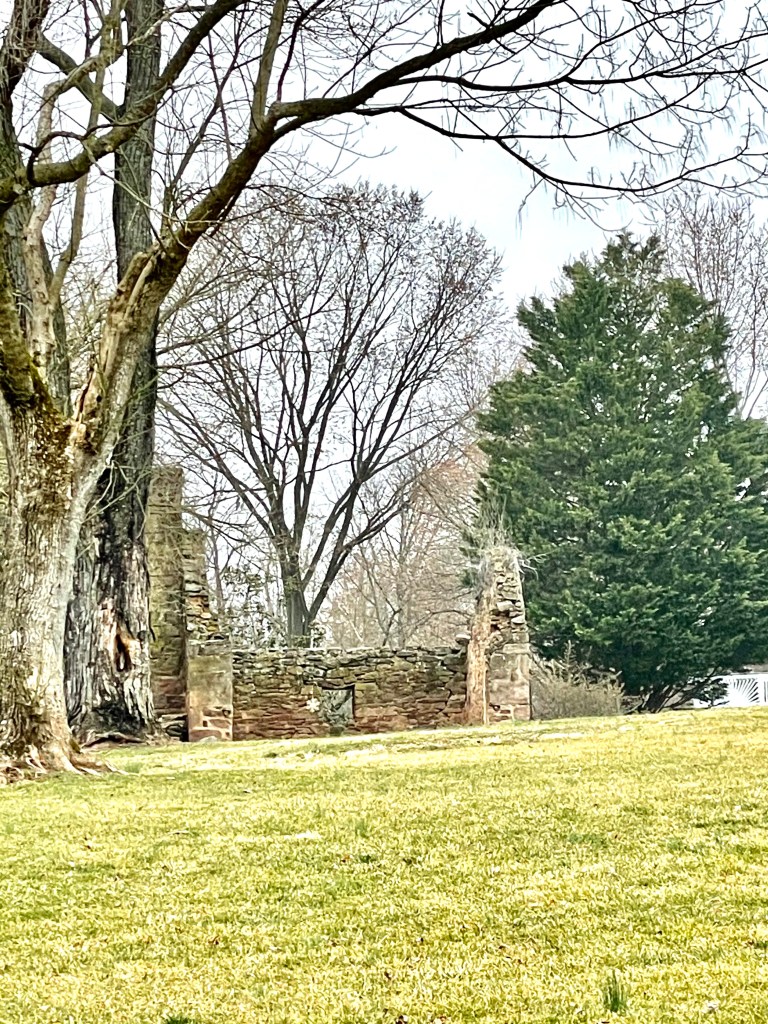
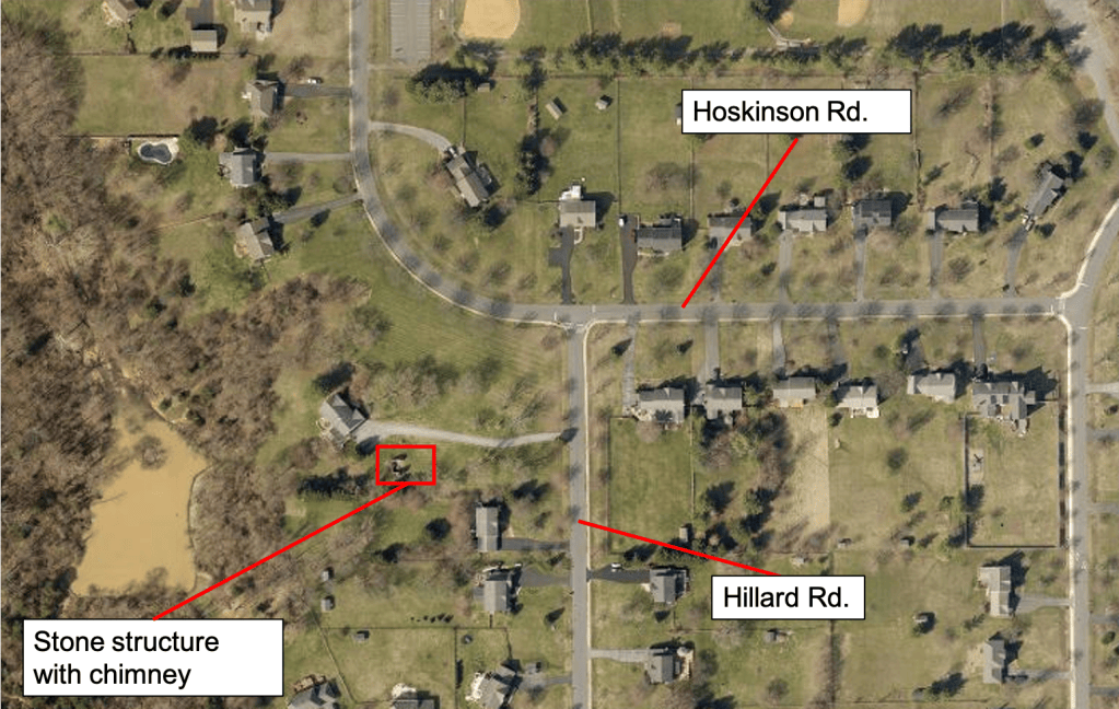
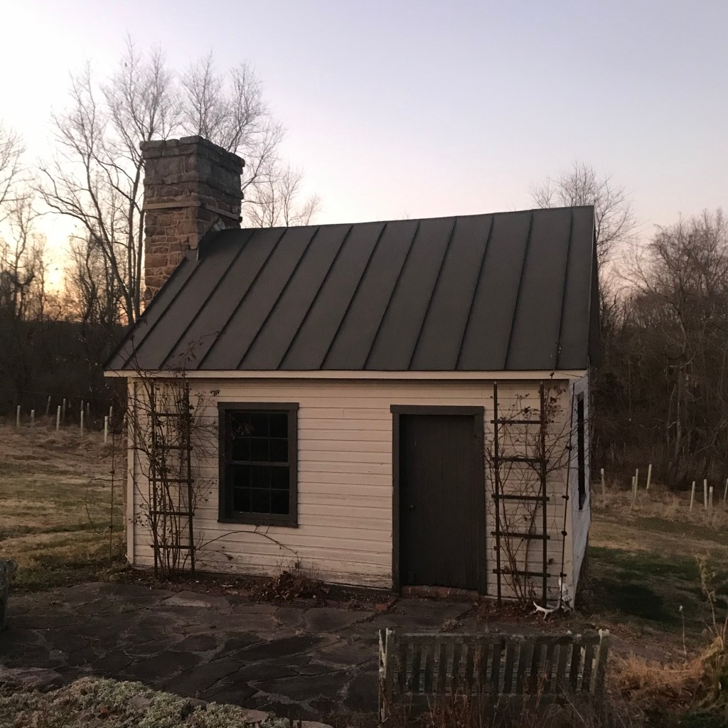
Up close, it looks like this:
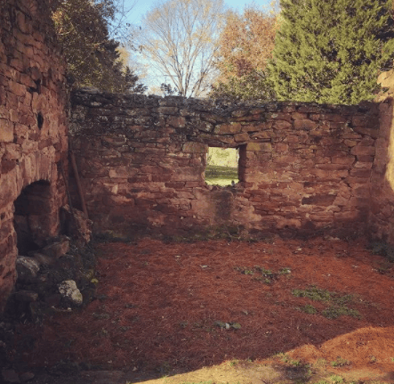
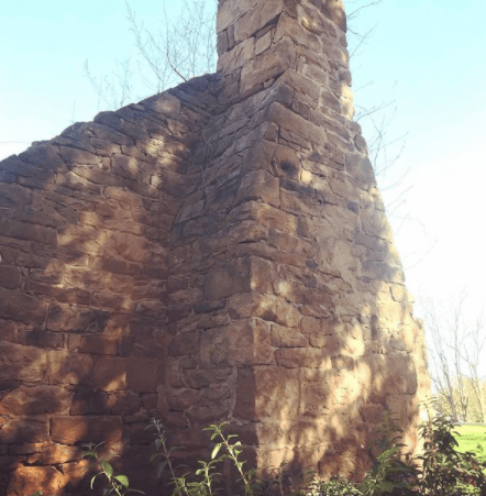
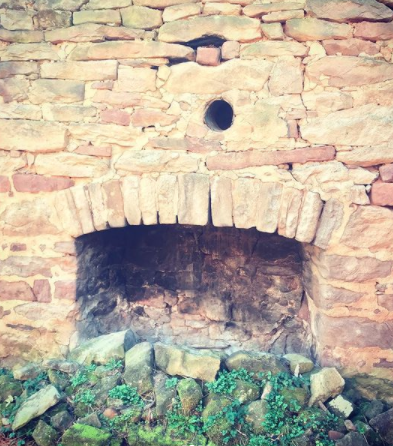
It’s odd to see such an old structure sitting in the middle of the neighborhood. It’s clearly older than all the houses around it, but what’s the story with this place?
As is typically the case, the first thing I do when trying to learn more about something like this is to use the Maryland Historic Trust’s interactive map (known as Medusa) to see if any registered historic properties show up in this location. Lucky for us, there is an entry available at the exact spot. You can read the report for yourself here.
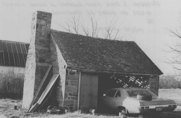
From the report, we learn a few key pieces of information: 1) At this location was a farmstead for Frederick S. Poole; 2) At the time of the report creation (1974), the farmhouse present was not the original farmhouse (unfortunately, we are not provided pictures of this home); 3) On the site were two stone structures: a meat house and either a quarters or summer kitchen (the chimney being the main clue). Included in the report are some great black and white photos:
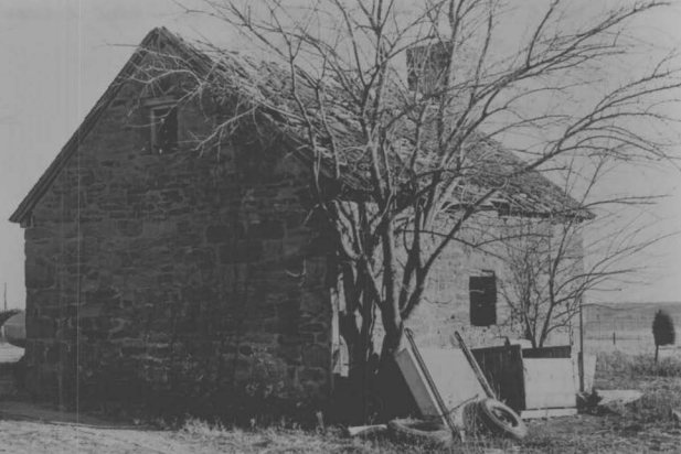
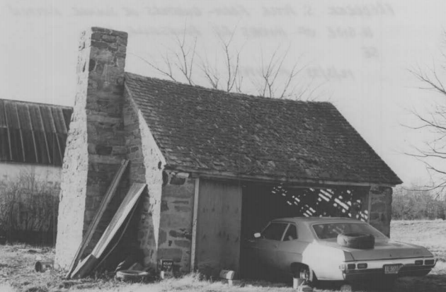
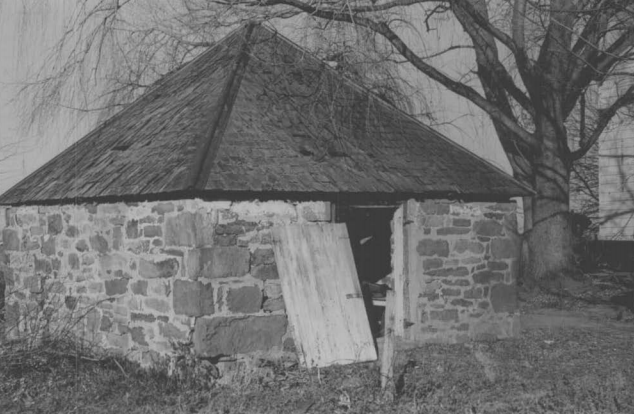
It’s pretty obvious when comparing the pictures of the structure with the chimney from the 1970s with those of today that we are at the right place. But what more can be learned about this farm? Using overhead imagery from the last few decades, we can begin to better understand the layout of this farmstead.
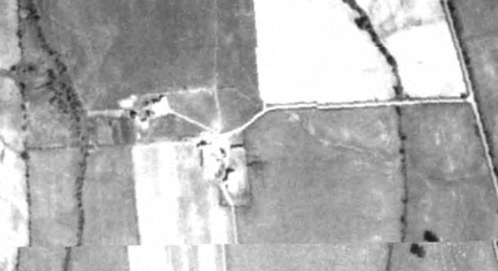
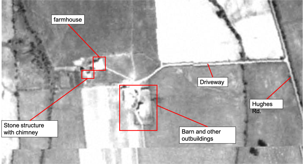
Here’s the earliest overhead imagery from 1951. I’ve also included an annotated image to give you a better sense of what you are looking at. And yes, you are seeing that correctly – back then, the driveway stretched all the way out to Hughes Rd.!
We can then jump to overhead imagery from the 1970s, which shows us a similar landscape to that of the 1950s, but the clarity is much better (note that the pond behind the home, which is still there today, is now present. Indicating that it was manmade between 1951 and 1970).
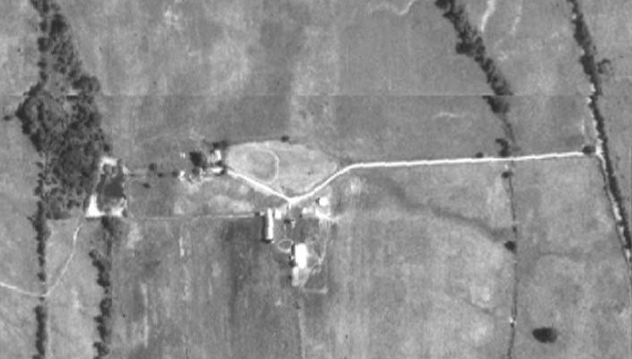
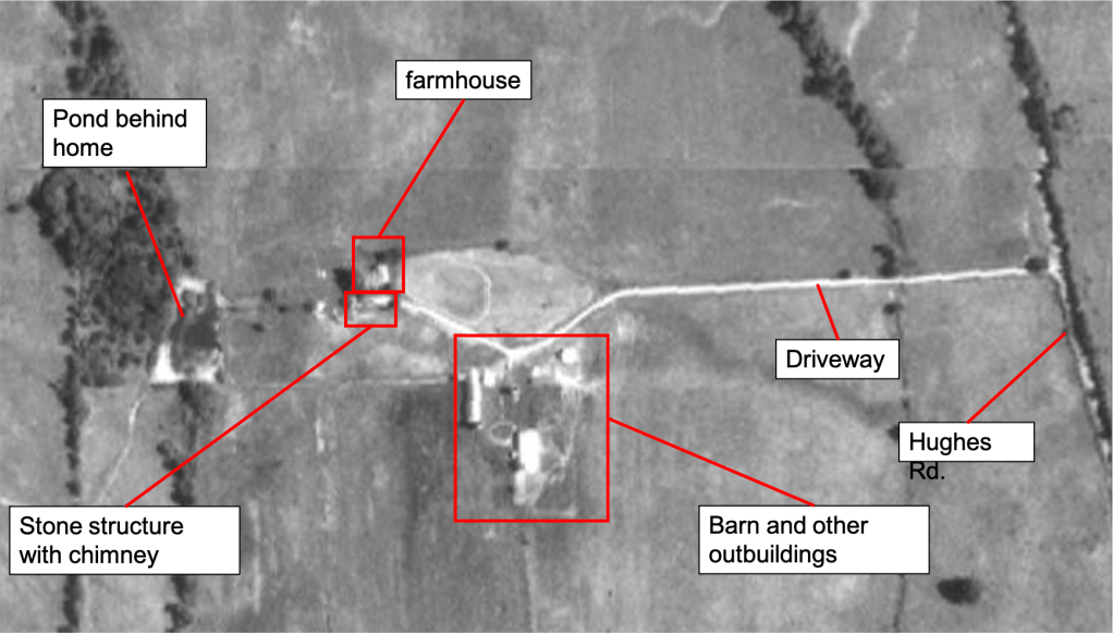
The next available overhead images come from the 1990s, and as you can see, the Hunter’s Run neighborhood has been recently completed at this point.
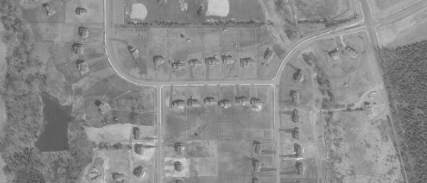
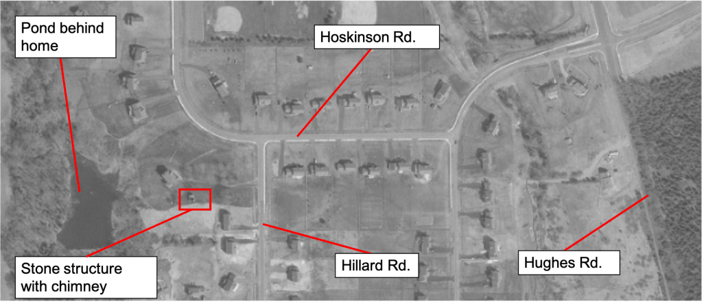
With these overhead images we get a good sense of how the landscape has changed when viewed from above. But it would be interesting to see how the old farmstead looked from the ground level. In an effort to see if I could locate any interesting pictures, I went to the Vintage Aerial site. This website is effectively a database of thousands of pictures taken from airplanes in the 1970s and 1980s. I frequently use it when searching for old homes that are now gone. While you can refine your search for pictures down to a general location, you will typically still need to search through hundreds of pictures to find what you are looking for.
Scanning through hundreds of photos, I was looking for any features in the pictures that resembled features from the overhead shots in the 1950s and 1970s. I was also looking to see if the small stone structure with the chimney showed up.
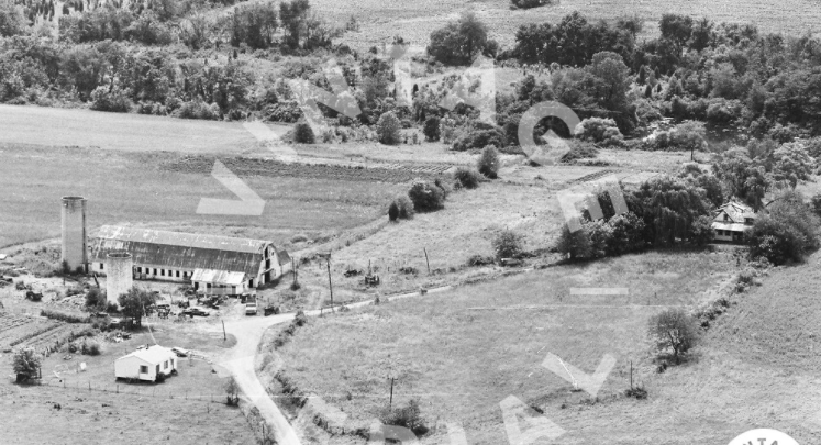
After about an hour of searching, I caught a glimpse of this picture from the 1980s:
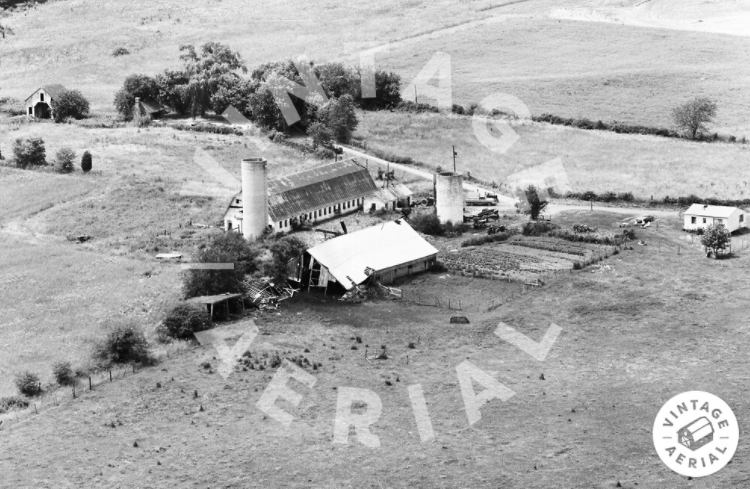
You have to look closely, but you can just make out the small stone structure with the chimney. Once I saw that, I noticed that the drive way in this picture has a little curve to it as it swings past the barn and silos before heading towards the farmhouse (go look at the overheads again and you will see this distinctly). You can also see the corncrib barn right behind the stone structure. Go back to the black and white images from the 1970s and you can see this corncrib sitting behind the structure. The plane would have been flying somewhere up above where the intersection of Hillard Rd. and Hillard Ct. are now and looking north to get this shot.
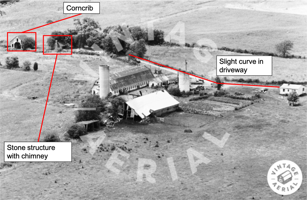
With confirmation of the site through this picture, it becomes significantly easier to find other pictures from Vintage Aerial of this old farm (after all, now we know what the barn looks like, how the two silos are positioned, what the corncrib looks like, etc.).
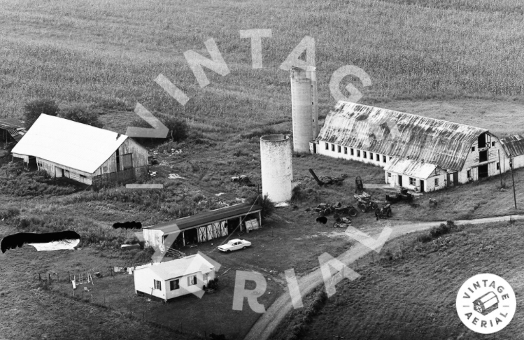
First we see this additional image from 1980 but from a different angle:
The above picture is pretty cool because now we are able to see the farmhouse. (Unfortunately, as noted in the historic report, this is not the original farmhouse). You can also see the pond in the background (it blends in with the vegetation). The stone structure is to the left of the farmhouse but our view is blocked by the trees.
Going back and looking at aerial shots from the 1970s, we come across these two pictures from 1973. They present largely the same landscape but provide a closer look at the farmhouse and outbuildings. I was hoping to see evidence of the stone meat house, but my guess is that it’s somewhere in there behind trees. (If you look super close, you can just barely make out the top of the chimney from the stone structure to the left of the farmhouse).
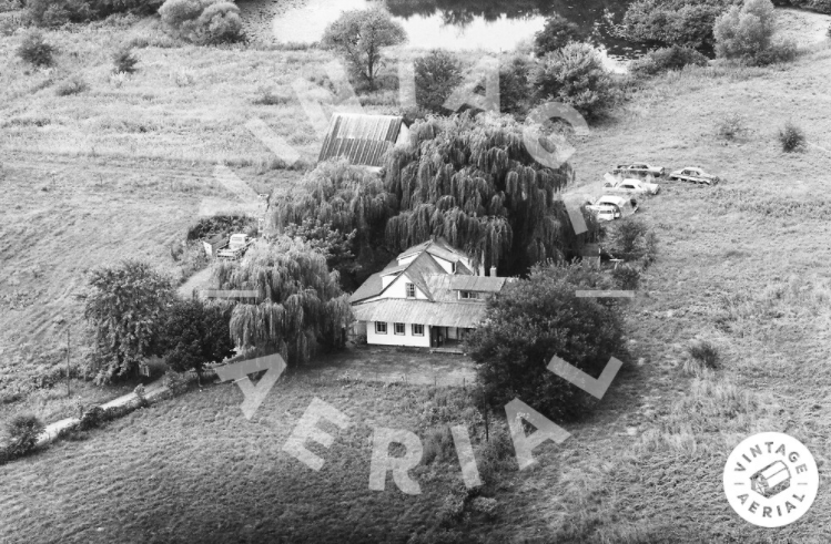
So while we don’t have any old pictures of the original farmhouse (I’m hoping maybe a reader here does!?), we now have a pretty good sense of what the farm and surrounding landscape looked like.
But who was Frederick S. Poole? Obviously the Poole name is familiar in these parts and we can use the Find A Grave website to learn more about him (hat tip to my good buddy Glenn Wallace who has done amazing work in the area documenting the historic family trees of those who occupied this land before us). At this page, we have access to pictures of Frederick and his wife Mary Tillard Douglas Willson Poole. We also learn that Frederick was the 5th of 10 children born to parents John Poole (yes, that John Poole!) and Mary Prisilla Woodward Sprigg Poole. We also learn that Frederick and Mary had 11 children and are buried at Monocacy Cemetery.
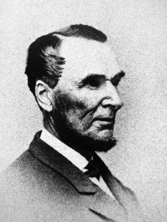
Frederick S. Poole (1809-1888) 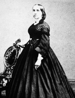
Mary Poole (1812-1883)
So what about the stone structure with the chimney that is still present at the site? As previously mentioned, it could either be a summer kitchen (in the 1800s, kitchens were frequently detached from the main homes to prevent fires) or a quarters (very likely for enslaved persons given the similarities of this structure to other enslaved quarters still standing in the Ag Reserve).
Here’s a great example of a preserved summer kitchen as seen at the White-Carlin Farm in Boyds. As you can see, it’s nearly identical to the stone structure in question on the right (there’s stone behind that white siding). I would note that the fireplace opening on the inside of the White-Carlin summer kitchen is much larger than that of the Frederick Poole farm. This is potentially important, as we would expect a fireplace used for cooking to be larger to allow for a swing-arm to cook food over the fire.
If we look at similar enslaved quarter structures in the Ag Reserve, we can see obvious similarities as well. The structure at the Frederick Poole farm is smaller than most enslaved quarters in the Ag Reserve, but pretty similar to those found at Darnall Place and Dowden’s Luck (the small size could simply be the result of fewer enslaved persons on the property when built).
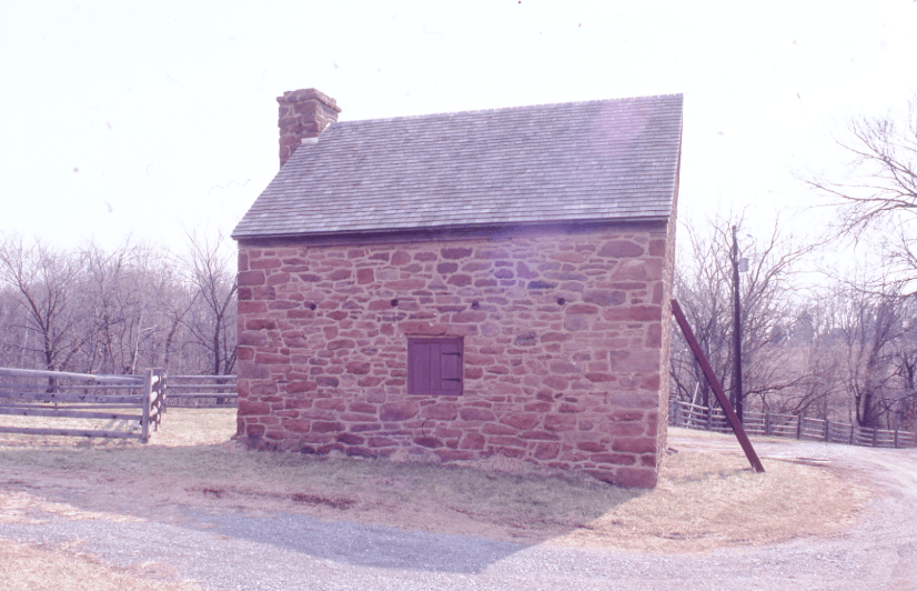
Darnall Place 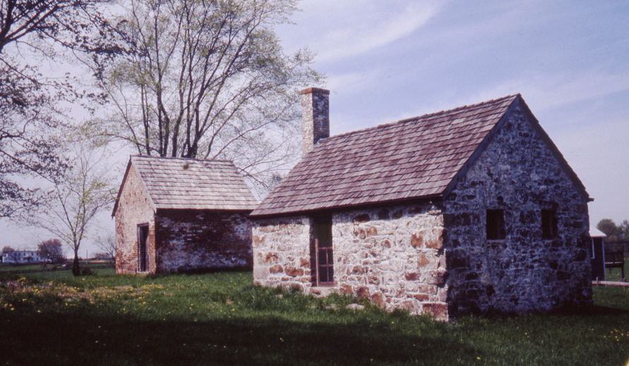
Dowden’s Luck
Ultimately, I’m not completely sure of the purpose of the structure at the Frederick Poole farmstead, but perhaps with more digging we can find conclusive evidence to lead us in one direction or another. What do you think?
Have another location in the Ag Reserve that you’d like me to spend some time chrono-locating? Let me know!

