Exploring and Highlighting the Incredible Historic Properties in Montgomery County, Maryland's Agricultural Reserve
Poolesville’s Historic Streetscape
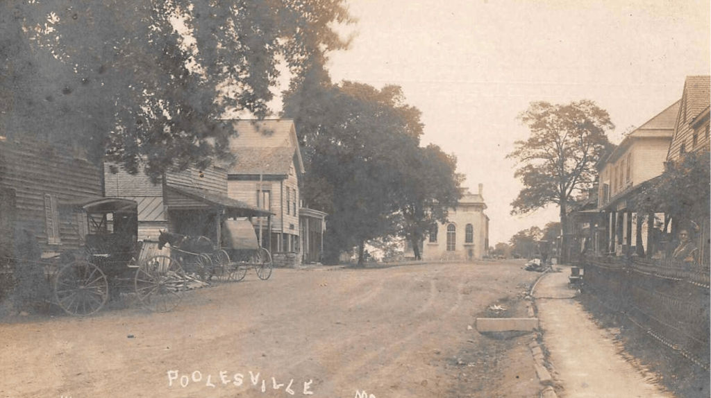
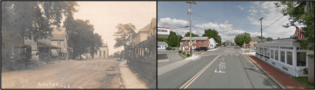
Fisher Avenue, as seen around 1910
There’s no question that a lot has changed in this small town over the last 100 years. New buildings, new neighborhoods, new residents. Some of the biggest changes occurred in the 1970s as the development of the Westerly, Wesmond, and townhouse neighborhoods came into existence. To look at overhead images of Poolesville in the 1950s compared to those from the 1980s is to observe a significantly expanded town footprint. In the last 30 years we’ve seen further expansion – Seneca Chase, Hunter’s Run, Elizabeth’s Delight, Stoney Springs, Brightwell Crossing, Tama, Westerly Grove, etc.
Despite these changes, much of today’s streetscape in the central part of town is easily recognizable to the streetscape of 100 years ago. While we did unfortunately lose a number of structures in town to fire in the 1920s and 1930s, enough of the early buildings and homes remain to orient us to the landscape. Said in another way, if you were to be dropped into the center of Poolesville in 1900, it would look a bit different but you could still easily find your way through town. This might seem obvious and/or insignificant, but the same could not be said for most towns in Montgomery County.
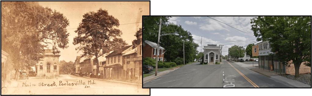
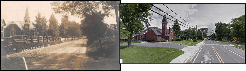
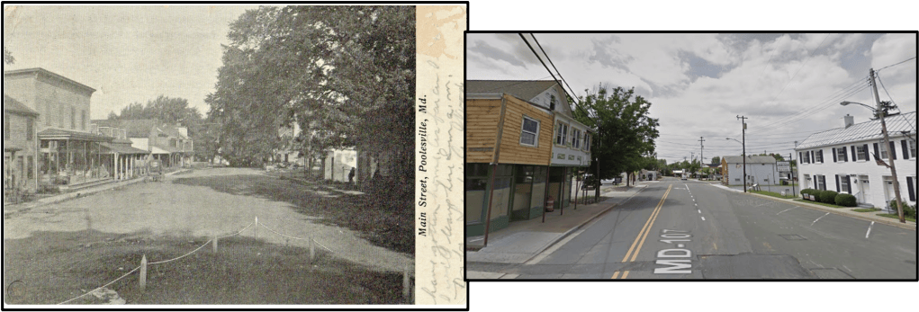
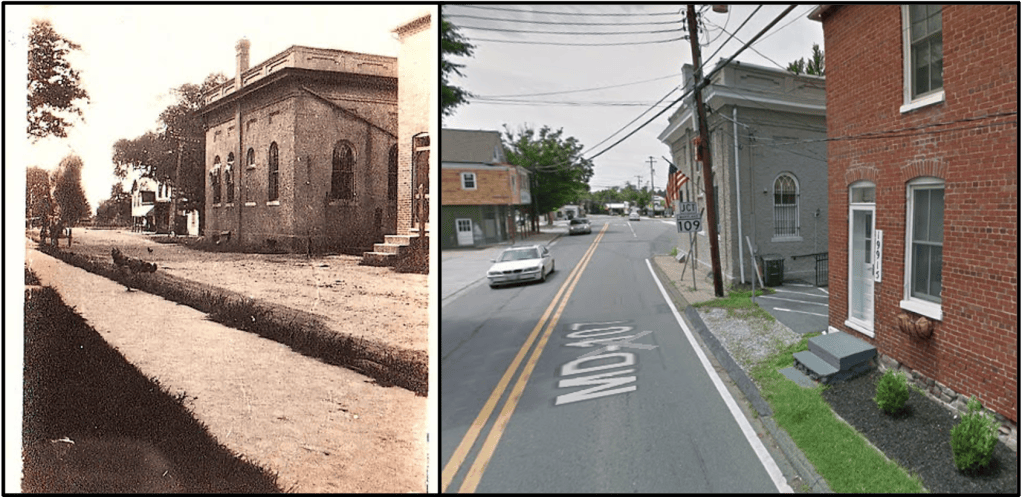
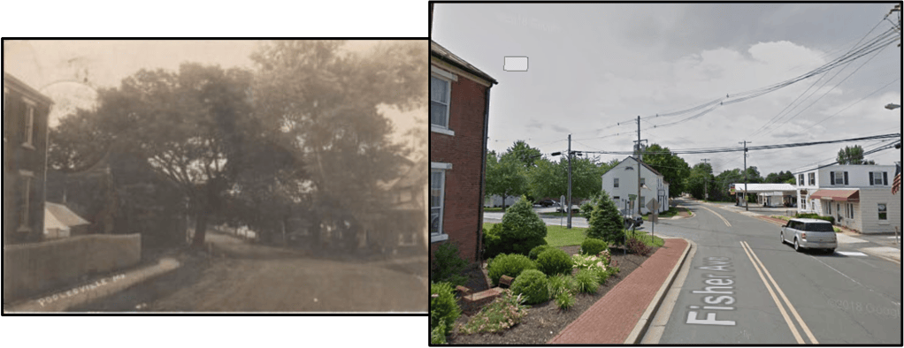
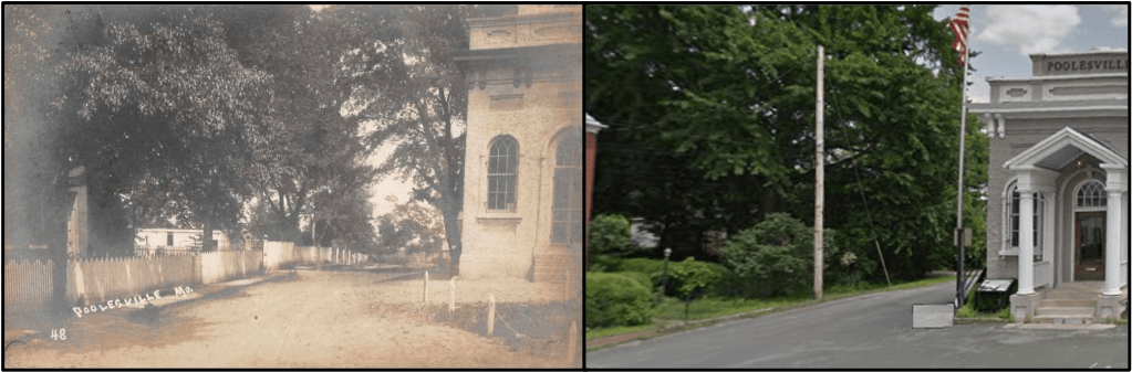
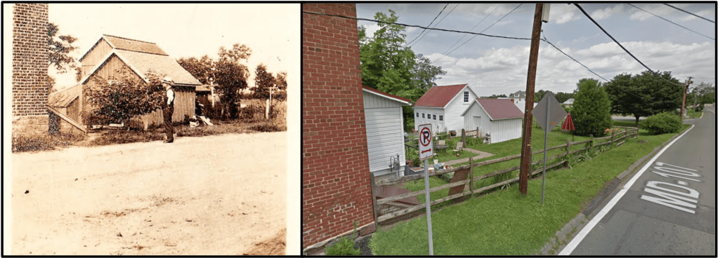
What will the Poolesville landscape look like in 2100? The below “Then and Now” shots compare photos of Poolesville’s streetscape from around 1910 to Google Streetview photos taken in 2018. Some things change, some things remain.
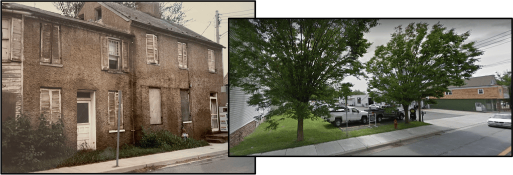
Looking towards the Old Town Hall (in 1910 it was the Bank). Most of the homes on the right side of the street were destroyed by fire in the 1920s and 1930s, but the homes down next to the bank building are mostly still there. These pictures show the entrance to town along Elgin Rd. with the Methodist Church ahead. Look carefully though, the two churches are not the same! The first Methodist Church burned down sometime not too long after the picture on the left was taken. These pictures are taken looking towards the main 4-way intersection from the front of the Old Town Hall. If you look closely way down the street in the photo on the left, you can just barely make out the roof lines for the Frederick Poole and Dr. Thomas Poole homes, which still stand. An interesting angle on the Old Town Hall. Don’t miss the wide sidewalk and the roaming chicken!I’m not 100% convinced this comparison is correct, but I’m fairly certain that the brick building to the far left in the 1910 photo is the side of the Dr. Thomas Poole House (willing to entertain other ideas though!). On the left, we see Coxen Rd., which is use to connect down to where Whalen Commons now exists. The Veirs-Stevens House (home to Locals Cafe) and the John Poole House are just out of sight.These pictures show the eastern corner of the Beall House and associated outbuildings. Note in the old photo how high the foundation stones come off the ground and how wild the landscape looks past the outbuildings. The old photo here might be my favorite. Take note of the horse buggies, the drainage ditch (Fisher Avenue must have been a swamp when it rained hard) and the woman looking at the cameraman in the far right. Aside from the Old Town Hall, most of these buildings are gone. The old Kolhoss Home, built by Dr. Stephen Newton White around 1840 and torn down in 1985.