Exploring and Highlighting the Incredible Historic Properties in Montgomery County, Maryland's Agricultural Reserve
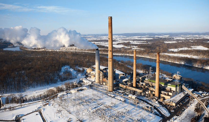
The Dickerson Generating Station
When we lose an old home, we also lose many of the stories about the people who lived in them. If we’re lucky, those stories have been recorded, but in a lot of cases they are lost for good.
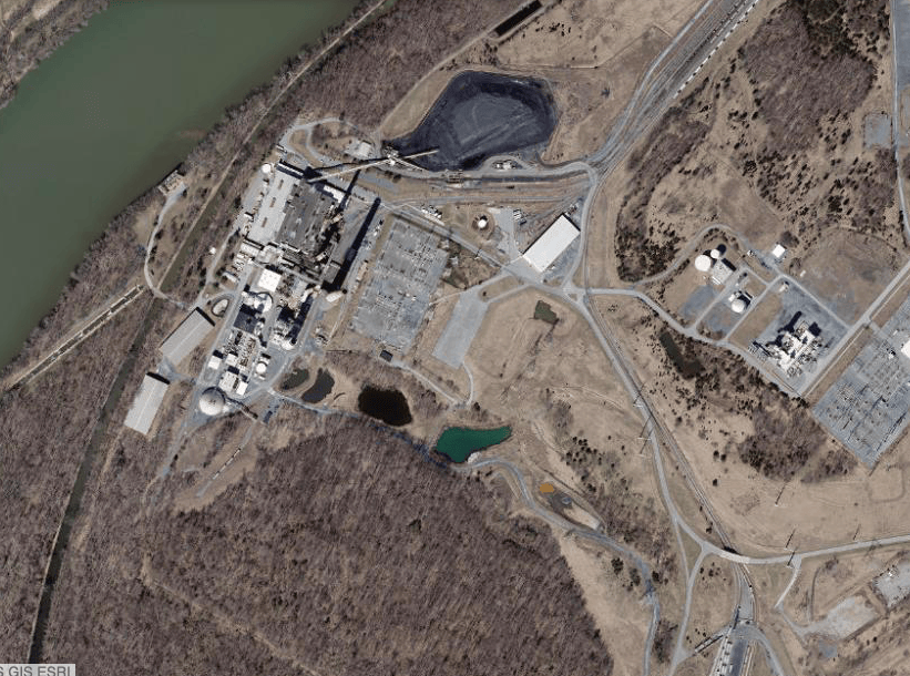
In the late 1950s, the Dickerson Generating Station was built along the Potomac River and over the years, the station’s footprint has grown. The land upon which this facility was built is fertile ground, and as such, multiple farms were demolished to make way for the construction.
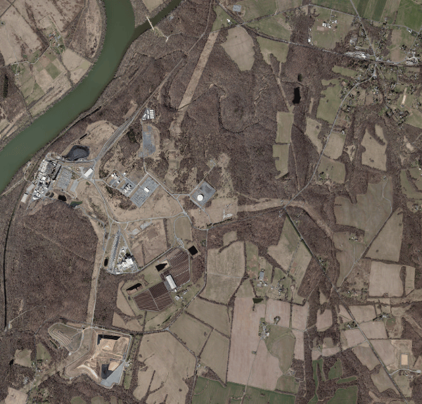
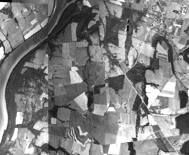
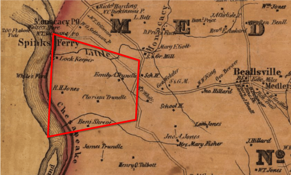
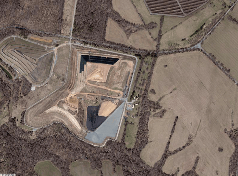
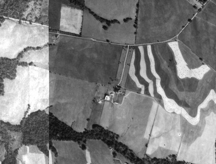
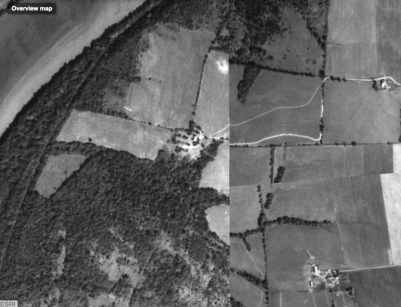
I’ve recently been playing with some software that allows me see overhead imagery from the 1950s through today in an effort to determine what was lost and possibly uncover some stories that might still be out there. Using the imagery and maps from the 1860s and 1870s, we can start to get a general sense of who occupied this land prior to the generating station. I know for a fact that we lost at least 5 farms and the Trundle Family Cemetery, but there is probably more. (See pictures for more details.)
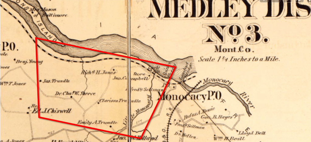
Here’s an overhead shot of the station as of 2017. The footprint of the plant also includes the Montgomery County Resource Recovery Facility, which I believe accounts for the mounds to the south of the plant.Here’s an identical shot of the area from the prior picture, but this one is from 1951. If you look closely, you can count at least 5 farms that were present.The 1865 Martenet and Bond Map of the Medley District. The area in red is the general area shown in the prior overhead pictures. As you can see from the map, in the 1860s, this land was largely farmed by members of the Trundle, Shreve, and Jones families (there was a lot of inter-marriage between these families and others in the area, such as the White’s).
From limited records, we know the following about people listed on the map:
Clarissa Trundle (1811-1885): Buried at Monocacy Cemetery. Emily A Trundle (1814-1878): Buried at St. Mary’s Cemetery Benjamin Shreve (1831-1916): Buried at Monocacy CemeteryThe same area taken from the 1879 Hopkins Atlas Map.My understanding is that the waste from the buring of coal at the plant is buried in these large mounds to the south of the plant. If you look closely in the center of the image, you can almost make out a tree-lined driveway. Look at the next picture and it will be more clear.Here’s the same shot, but from 1951. Based on the location, I believe this was Dr. Charles Shreve’s Farm. Dr. Shreve (1834-1914) was a local doctor in Dickerson who had degrees from Georgetown and the University of Maryland. He married his wife, Ann, in 1859 and it’s my understanding that they lived most of their lives on this farm.
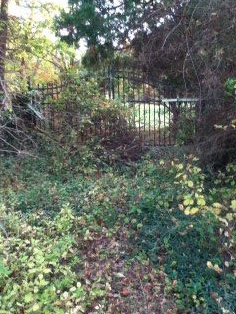
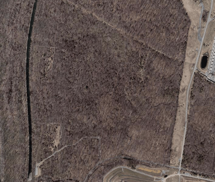
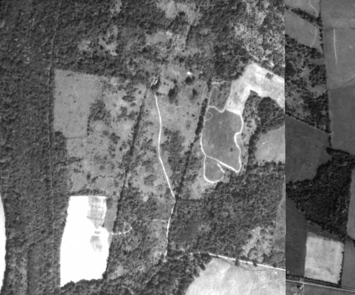
If you drive down Martinsburg Rd., you can still see the stone gate and tree-lined driveway. Unfortunately Dr. Shreve’s home was demolished sometime in the early 1990s. I have no idea what it looked like.The gate to what I believe was Dr. Shreve’s tree-lined drivewayThis picture shows woods between the plant and the C&O Canal (to the far left). It doesn’t look like much more than woods today, but it was once thriving farmland.Here’s the same shot from the prior picture, but taken in 1951. I’m not entirely sure who owned the farm here, but a historic marker at the canal just south of here indicates it belonged to the Trundles (which makes sense).
Supposedly, there is an old chimney deep in the woods that still remains. I’ve looked for it a few times, but never found it. With this new ability to see imagery from the 1950s, I’m confident I will find it soon.Here’s a close-up view from 2017 of the spot where Dr. Shreve’s home use to stand.Here’s the same vantage point from the prior picture, but taken in 1993. You can see the Shreve home in this one (it kind of looks like a cross from above). It’s here in 1993, but gone in 1998, along with a lot of the farm buildings behind the home.
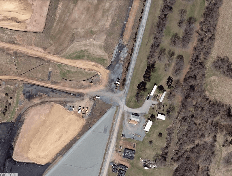
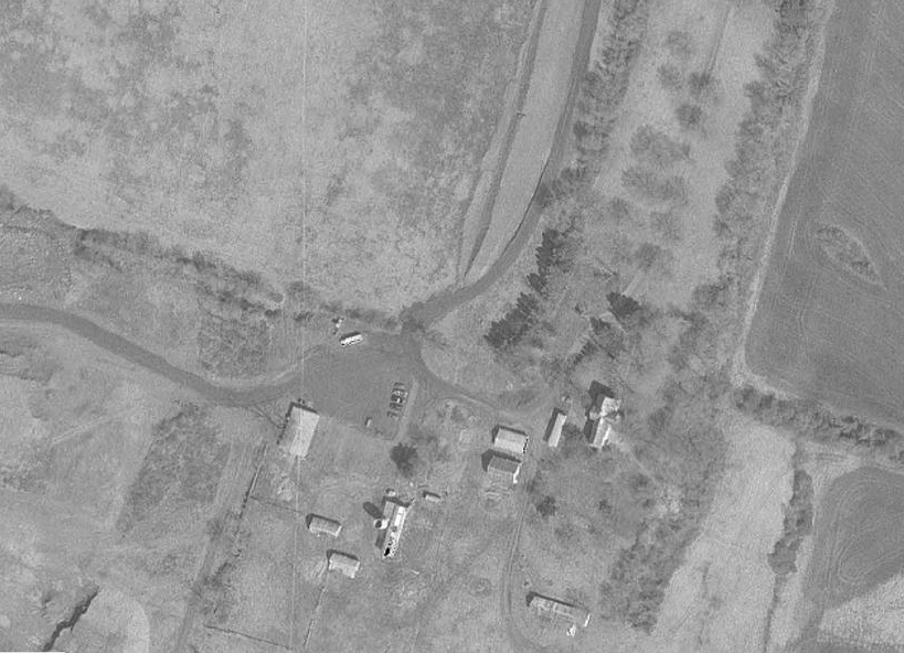
In the very early 90s, when I was around 6 years old, my dad and I explored an abandoned home in this general area. Neither of us have been able to remember where exactly the home was, but I do remember some details (a long tree-lined driveway, a smokehouse in the back, a stone foundation). I’m nearly certain that the reason I haven’t been able to find the house in the last few years (and believe me, I’ve been looking!) is because it’s this one, which was probably torn down shortly after we explored it. I wish we had taken pictures!Here’s a tighter overhead shot of the generating station taken in 2017. Note the coal used to fuel the plant.Here’s the same area from the prior picture, taken in 1951. I believe the home in the center belonged to Richard H. Jones (I’m not 100% on this).